GNSS RTK GPS
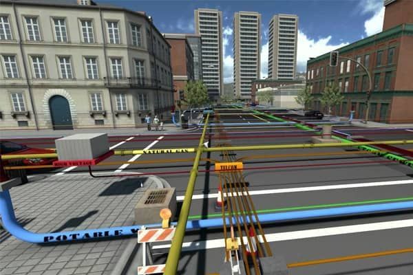
Utility mapping, often known as underground service mapping or utility locate and map, is the process of locating and mapping underground utility networks within a specific area. This essential task involves identifying and documenting various utility assets, including water pipelines, gas lines, electrical cables, telecommunications networks, and sewer systems.
Utility mapping serves a crucial purpose: to create accurate, detailed maps or plans that depict the location, depth, and type of underground utilities. This information is indispensable for decision-making, risk assessment, and coordination among stakeholders involved in construction, maintenance, and excavation projects.
Utility mapping significantly contributes to preventing damage to utility infrastructure, minimising disruptions, ensuring safety, and improving the overall efficiency of managing underground utility networks.
Utility mapping is the foundation of effective infrastructure planning, construction projects, maintenance activities, and the overall management of utility networks.
The integration of Global Positioning System (GPS) data with Geographic Information Systems (GIS) enhances the accuracy of utility mapping by creating geospatially accurate maps.